Categories
Trekking

Kolhai Base Camp Trek

Kolhai Base Camp Trek

Kolhai Base Camp Trek

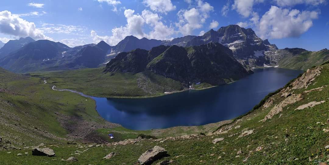
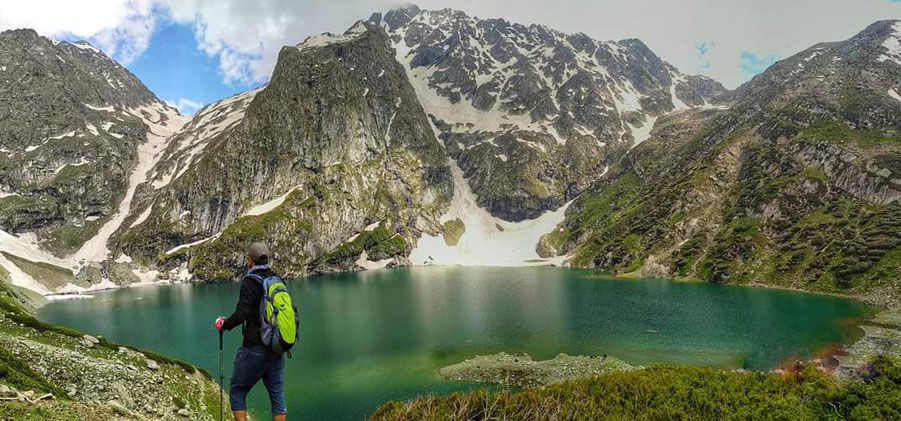
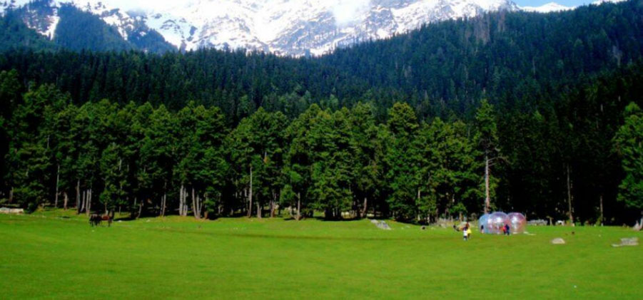
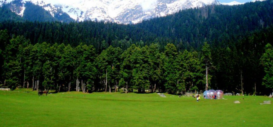
Kolahoi Base Camp Trek is one of the dazzling trekking spots in Kashmir. Kolahoi Base Camp (4140m) is a best trekking trip and it promises to be a glorious experience for the trekkers. Kolahoi Base Camp Trek moves across green meadows of Aru Valley in Pahalgam, dense forest of Lidderwat (3050m) and Satlenjan (3420m) and the highland lake Tarsar. Many national and international trekkers participate in this trek.

Day 1: Pahalgam to Aru to Lidderwat

Altitude: 7958 feet to 9131 feet

We start from Pahalgam by a car in the Morning and reach to Aru in half hour.From Aru we go on foot to the wonder spot Lidderwath . We can also go by horses. Aru is eleven kilometers from Pahalgam and Lidderwath is also eleven kilometers from Aru. All along th way we live the scenery of lush green pine trees and of the serpentine tributary of river Lidder, singing all the time. We arrange all types of equipments needed for trekking . Beauty surrounding best assimilated when we are on foot.We can enjoy lunch at place called Draaidar.while walking we would feel beauty. The mind blowing beauty gives out heeling energy.

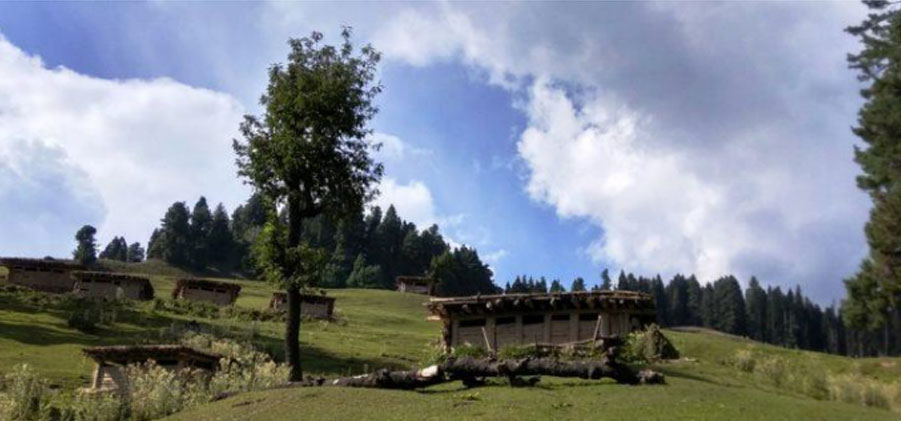
The medicine for heart and mind. We rest and resume for Lidderwath. We reach to Lidderwath. It takes us four hours on foot to reach Lidderwath. It is a wonderland . it is regarded one of the best spots. Here we camp and feel home away from home. It is almost plain meadows with big two streams flowing along its two sides sourrounding us are mountains covered with pines. All along the way here at Lidderwath we would see gipsy families living in mud houses during warm months of the year. These families have their own traditional culture not affected by so to modern culture. They are simple people.their they rear cattle and sell milk and milk products. We enjoy at Lidderwath camp fire till late night. The sight of this fire gives our heart happiness. We sleep in tents and enjoy dreams.


Day 2 Lidderwat to Tarsar Lake back Lidderwat 
 

Altitude: 9131 feet to 12,451 ft to 9131 feet

After breakfast we begin for Tarsar lake. It will take us five hours to reach Tarsar and then back to Sekiwas. On reaching to the lake we would feel on the top of the world. Here we would see no trees. The lake is surrounded almost from all sides by snow covered mountains. It is a big lake and one has to be ready to assimilate its beauty. It is deep, full of transparent water. It is basically a snow feed lake. Here we take lunch and have rest. We reach back to Lidderwat and enjoy night here.


Day 3 Lidderwat to Kolhai Glacier back Lidderwat

Altitude: 9131 feet to 11,170 ft(Kolahoi Glacier View Point) to 9131 feet

After breakfast we begin for Kolhi Glacier. – The source of river Jehlum flowing through the middle of Kashmir. It takes us three hours to reach Kolhi Glacier.it is impressive. Here we would find shepherd families rearing sheep. It takes us to three to reach to Kolhi and two hours to reach back to Satlanjan we enjoy another night at Lidderwat.


Day 4 Lidderwat back to Pahalgam

Altitude: 9131 feet to 7958 feet

We have breakfast and start back to Pahalgam. We return back to Pahalga

Categories
Trekking

Tarsar Marsar Trek

Tarsar Marsar Trek

Tarsar Marsar Trek

The lakes of Tarsar, Marsar and Sundarsar

The Tarsar Marsar trek is in Kashmir. Trekking in Kashmir is very different from trekking anywhere else in our country. Nowhere else do you get to trek next to such spectacular alpine lakes. On this trek, you get to camp beside two such beautiful lakes – Tarsar and Sundarsar.

The spectacular meadows of Kashmir

The beauty of the Tarsar Marsar trek does not end with the lakes. The meadows of Kashmir are something to look out for too. On this trek, you find these exquisite meadows on every day of the trek. The forests, clearings and woods surrounding these grasslands make them come alive even more. Sometimes, as trekkers you move from one meadow to another separated by just a patch of forest.

Day 1: Trek from Pahalgam to Aru to Lidderwat


Altitude: 7958 feet to 9131 feet Distance: 10 kms Time taken: 6 hours Trail type: Gently climbing long trail It is a gentle but long climb from Aru to Lidderwat covering a distance of 10 km in 6 hours. The trail to Lidderwat starts to climb straight out of the village, following the course of the Lidder River. Follow the wide trail past the agricultural department’s fence. Look back to take a commanding view of the entire region of Aru. The trail gets into a cluster of fir trees and continues to climb. Half an hour later, the trail pops out at a clearing called Dalla near Gujjar huts. Out of the pine trees, the trail gently climbs a mound, from the top of which is one of the most fascinating sceneries of the day. The Lidder River meets with the trail at the valley bottom, spreading out in springs. Next to the river are grassy glades where the trail runs. Beyond, the Lidder rushes out of a curve around more gorgeous fir forests. It takes about half hour to cross this lovely section of the trail and enter the cluster of firs once again. Across the forest and ten minutes later, are the superb meadows of Lidderwat. There are a few Gujjar huts that signal Lidderwat. A sensible option is to drop down to the wooden bridge, climb out of the meadows on the other side and camp anywhere. On the other side are lovely clear streams running across the meadows – this is vitally important if you are camping for the night. Pahalgam District Authority huts for accommodation. There are also plenty of places to pitch camp.The Lidderwat camping site is a dream. Clear streams run across the meadows. Spare time to take long walks that stretch to either ends of the meadows.

Day 2: Lidderwat to Shekwas


The trail to Tarsar starts to climb right behind the PDA huts – following the course of the river flowing alongside. It leaves the river below and climbs very quickly into the pine forest above you. The trail is straightforward and does not pose any challenge.Continue to climb past clusters of pines and clearings for an hour and a half, until a stunning view opens up before you. The narrow valley of Lidderwat opens up to tracks of wide sweeping grasslands. The grasslands merge with the towering mountains, with snow patches in their folds. It is no longer a single valley but many valleys that converge together. The trail ahead converges upwards and to the left past the Bhakarwal shelters, sticking to the right of the river.

Clear streams run down and cut through the trail many times. There are good spots to fill water. Avoid taking the upward trail. Drop down to the river and cross it, first hopping over a few boulders and then crossing a make-shift long bridge. Follow the river and continue to climb the trail. Half an hour later, the trail around a bend opens up to a wide clearing of Homwas.

There are a few friendly Gujjar huts where you can stop for tea. It is a delight treading on the trail after Homwas. It is mostly on grass and feels lovely under your feet. The trail, now in a south westerly direction, enters a narrow valley with blue waters of the river as constant company. The climb continues to gain altitude. An hour later, you will pass a very old cluster of Silver Birch (Bhoj) trees, and the view opens up to another stunning scenery.

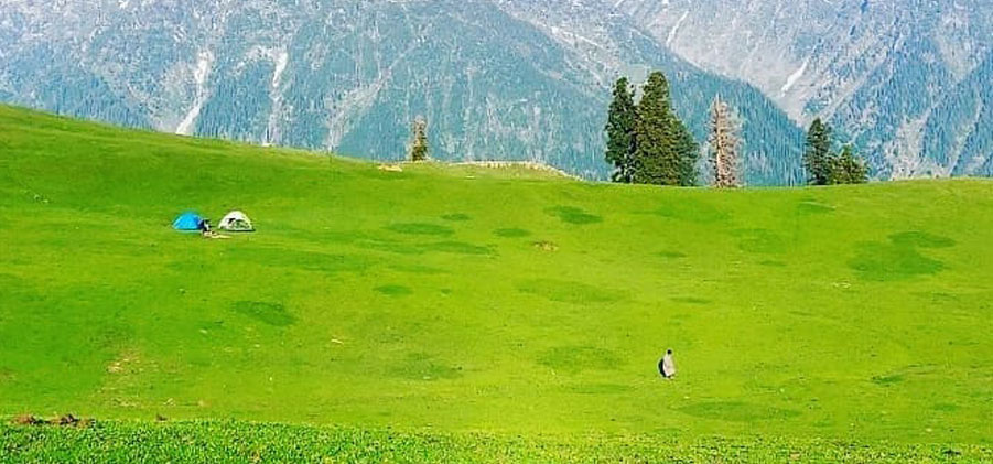
This time, a possibly wider grassland leads to two wide green valleys. It stretches out vastly in front of you. Undulating meadows on your left reach out for the sky. Beyond the meadows, tall, dark, snow-patched cliffs shadow the landscape. The trail climbs swiftly past a few Gujjar huts to the camping grounds of Shekwas. For those on the Tarsar trail, Shekwas is a logical and extremely pretty camping ground. It is a good break after the hard climb.

Day 3 Shekwas to Tarsar


Past Shekwas, the trail again snakes its way through grass for a long while. The trail to Tarsar, meanwhile, climbs into a ridge that overhangs the stream. In a general westerly direction, the trail climbs rapidly towards a conical hill in front. The trail tops a few false ridges, each opening up to different wondrous sceneries.Two hours later, the trail finally gives you a narrow glimpse of Tarsar. Even the slight glimpse is a delight and it is a rush to reach the shores of the lake. Cross the stream over boulders and set your foot on the grassy glades of Tarsar. There are plenty of flat camping spots along the lake and pitching tents is not an issue. The lake is a stunning display of nature’s capabilities. The waters are turquoise blue and in a cauldron surrounded by snow patches feeding the waters of the lake. If ever there was a place that could come close to paradise, then the camping shores of Tarsar are it!

Day 4 Tarsar to Sundersar


The view from the other side of the Tarsar pass is another terrific attraction. The grassy valley stretches out from your left to right in a never ending stretch of beauty that boggles the imagination. Even the anticipation of your walk on the valley floor is enough to set the heart racing. On a side note, this is the same valley that leads to the Shekwas meadows. Most trekkers descend down from Tarsar, until Shekwas, turn left and get into the Sundarsar valley. By climbing to the pass you’ve saved 3-4 hours of the trek.

Descend from the pass on the shepherds’ trail that leads to the bottom of the valley. Catch up with the trail that runs along the stream on the grassy bed of the valley. Move up the valley, to your left and continue on the trail. Ten minutes later, spot a few Bakkarval shelters on your left. Behind the shelter, the trail climbs over a short stretch of boulders to tap a knoll.

What lies behind the knoll is something that poets reserve their best for. In a vast expanse of meadows, with a widening valley on your left, are the most lush grasslands you’ll ever see. Sheep graze gently on the meadows. Unmindful of your presence even as you brush past them. Horses munch on the same grass in gay abandonment. In the middle of the meadows, the stream turns into a large pond, fed by brooks from snow-melt of the surrounding mountains. Snow patches on the mountains offset the greenery of the meadows.

This delight of nature takes about half hour to cross. Walk down the trails that lead to the end of the meadow. Towards the end, superbly laid boulders cover the stream. They are laid out so well that it appears as if they were constructed there. Hop along the boulders, climbing rapidly for another 15 minutes, until you reach the base of a ridge that separates the meadow from the valley above it. To get to the top of the ridge, the trail climbs through a narrow boulder-lined valley for another 15 minutes.

Topping the ridge is another moment for the poets. Another meadow larger than the one you left behind sprawls out in front. Which is more beautiful, it’s hard to say. The settings are similar, almost identical. The valley floor is a vast bed of flowers. Far beyond is another ridge top – the exit route of the Tarsar trek. From the ridge top, look to your left and spot a grazing trail that leads into the folds of the mountains on your left. The folds lead to enticing snow-laden flanks of mountain sides.

Follow the trail that climbs past the stream running down the slope. Briefly, the trail hangs over similar well-laid boulders over the stream. Ten minutes later, the trail magically hops over landscaped grassy mounds to land on the lovely shores of the lake of Sundarsar. To your right and behind, are big flat stretches for camping. Sundarsar is the perfect camping spot after the lovely trek from Tarsar.

Day 5 Visit Marsar and go to Homwas


From Sundarsar, skirt around the shores of the lake from the right to get to the far side of the lake. There are two logical passes that one can climb. Both lead to Marsar. The quicker one is over the boulder-laden trail on the left. Climb over the boulders and trace a path towards the pass. Snow over the boulders can make the approach tricky. An ice axe or a trekking pole helps a lot to gain firm footing. It is a half hour climb to the pass. The pass is a lovely grassy stretch that has clear trails leading to flatter grounds just below it. Get down to the flatter stretches and occasionally hop over lovely brooks that run along the trails. Keep to the trail that veers to the left and spot a ridge that climbs on your left and in front.

Five minutes later, climb over to the top of the ridge for an amazing view of Marsar almost 600-700 feet below. Marsar is a hidden beauty, almost always engulfed under dollops of clouds and mist. Almost as large as Tarsar, Marsar is similar looking. Tall, snow-lined cliffs rise off the lake. On the left, the overrun waters of the lake run down a lovely green valley towards Traal. On the right, outer edges of the Dachigam reserve forest almost climb up to the shores of the lake. Head back the way you came up to Marsar and get back to Sundarsar in about 40 minutes of descent.At Sundarsar campsite, you have breakfast and start from Homwas. You retrace your steps to Jagmargi valley. Trekkers are extremely lucky to view these grasslands twice and from different directions. Instead of crossing the Tarsar pass, you take a different route to Shekwas. Roughly an hour of walking from Shekwas to Homwas. You are expected to reach Homwas just in time for lunch. You camp at Homwas for the night.

Day 6 Homwas to Aru.


Today you take the same route that you had taken at the beginning of the trek via Lidderwat. The trail goes downhill and it is a quick descent. It will take you 2 hours from Homwas to Lidderwat. The beauty of this part of your trek is that you will get to see all of those views that you had initially missed. The shrinking Kolahoi glacier is one of these sights. You will see the pine forests of Lidderwat that you had seen on day one of your trek in a whole new light. After getting some rest at Lidderwat, you head for Aru.

It is a 10 km walk from Lidderwat to Aru. This takes around 4 hours to cover. Stop for lunch en-route, you are expected to reach Aru by 4 in the evening.
Categories
Destinations

Pahalgam Tourism

Pahalgam Tourism

The Lidder river runs through Pahalgam in a rushing gray-green torrent, foam flecked, breaking in curling waves against the boulders that lie in its path. Its sound is an eternal as the whisper of wind through pine and fir, its force primeval its untamed splendor.

Long before this little village 96 Km east from Srinagar 2400 meters above sea level, became the popular holiday resort it is today, it was the preserve of nomadic shepherds. Its rugged charm has remained un-spoilt by progress, while a bustling main street and its wide range of tented camps, hotels and lodges have established it as a favorite holiday resort.

Pahalgam spreads along the banks of the Lidder, which is the focal point of interest to the angler.

The trout fisherman delight, the Lidder is divided into three fishing beats between Mattan and Phalgham, and the trout are so thick that even the first time fisherman can land a good catch. Pahalgam is perhaps best known as the take off point for trek into the surrounding mountains. The resort is well geared to meet the demands at onward going trekkers and camping equipments is readily available, as are ponies and porters. Walking the Lidder valley is scenically most rewarding, through forests of virgin pine, fording crystal clear mountains streams and through meadows of wild flowers, higher up the valley.

Popular treks from Pahalgam are to the Kolohao Glacier Via Aru, Satlanjan and Dudsar Lake, and to the high altitude lakes, that dot the meadowland and mountain ridges between Pahalgam and Sonmargh.

Cottages in a tourist village, a full fledged club and a large number hotels have come up this beautiful resort pilgrimage to a cave of an ‘ice-lingam’

There is something about the pure and re-vitalizing air of Pahalgam. Perhaps dense pine and cedar forests make it oxygen rich. Limited accessibility combined with limited telecom connectivity make it an ideal getaway from the grind of daily life and professional stress.

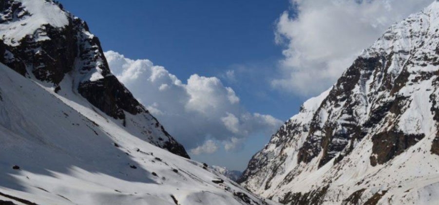
The town is at the junction of the Aru and Sheshnag Rivers and surrounded by soaring, fir-covered mountains with bare, snow-capped peaks rising behind them. The Aru flows down from the Kolahoi glacier beyond Lidderwat while the Sheshnag from glaciers along the great Himalayas.

Apart from adventures, Pahalgam is the starting point of the annual Amarnath yatra (holy journey) to the holy cave shrine of Amarnath, which is said to be the abode of Lord Shiva. Every year in the month of July/August, thousands of pilgrims descend on Pahalgam on their way to the holy cave .

Gulmarg’s astounding beauty, prime location and closeness to Srinagar naturally make it one of the prime hill stations in the country. Originally called ‘Gaurimarg’ by shepherds, its present name was given in the 16th century by Sultan Yusuf Shah, who was impressed by the sight of its green slopes embellished with wild flowers. Today, Gulmarg is not only a mountain resort of exemplary beauty – it also has the highest green golf course in the world, at an altitude of 2,650 m, and is the country’s major ski resort in the winter.

Tourist Attractions in Pahalgam

Chandanwari

Situated at 2,895 m and 16 km (10 miles) from Pahalgam, is the starting point of the Amamath yatra. The road from Pahalgam to Chandanwari is curvy, sometimes a relatively flat terrain, with quite a few steep curves. It can be undertaken by car (not busses and trucks for most part) with some skilled driving. From Chandanwari onwards the track becomes much steeper, being accessible on foot or by pony only. 11 km from Chandanwari is the mountain lake of Sheshnag, after which, 13 km away is the last stop, Panchtarni. A narrow spiralling path from Panchtarni leads to the Amarnath Cave. 

Baisaran

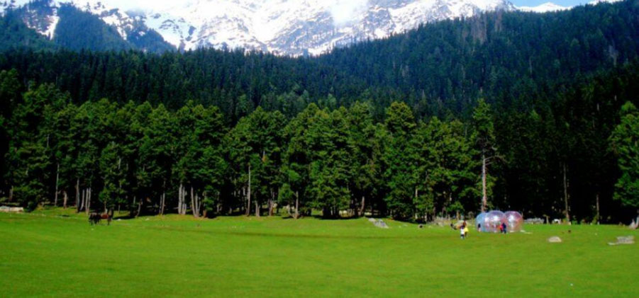
Pine forests dot this meadow which presents a picturesque view of the snow-clad mountains. The snow covered Tulian lake at an altitude of 3353 m is 11kms from Baisaran.

Sheshnag Lake

The waters of this greenish blue lake are covered with ice till June. Sheshnag lies at a distance of 13 km from Chandanwari and is at 11,330 ft above sea level. The place has derived its name from seven peaks that look like the head of Sheshnag, the sacred snake in the Hindu mythology. Panchtarni It is the confluence of five streams and gives

Panchtarni

Its name. For those headed towards the holy cave of Amarnath, Panchtarni is the last camping site. From Panchtarni, Amarnath is located at a distance of 6 km.

Amarnath Cave

Pahalgam is the base for the religious trek to the abode of Lord Shiva. A narrow spiralling path from Panchtarni leads to the Amarnath Cave. The massive ice shivlingam is visited by thousands of pilgrims between July and September.

Aru

This charming meadow can be reached by walking along a mountain path. The river Lidder disappears at Gur Khumb and reappears after 27 mts.

Lidderwat

A beautiful camping site set among dense forests. Starting point of the trek to the Sindh Valley.

Activities in Pahalgam

Pahalgam has lots of recreational activities especially trekking adventures. It offers wonderful treks, skiing, mountaineering and camping sites. Trekking can be undertaken to Kolahoi Glacier which is very beautiful via Aru village. Sledging at the frozen Glaciers is also offered by locals. You can take long walks in the jungles and explore rich flora and fauna. Pahalgam is the main base camp to Amarnath Cave. Alpine Skiing is also available at high altitudes. A Popular trek from Sonamarg to Pahalgam and trek to Chandanwari and Sheshnag lake can also be undertaken. The Liddar River is popular among travelers interested in angling. Stretches of this river are suitable for trout fishing. Pahalgam has a golf course at 2400 meters above the sea level. Camping equipment, ponies and skiing equipment is readily available.


Categories
Destinations

Gulmarg Tourism

Gulmarg Tourism

Gulmarg a prime location in the state of Jammu & Kashmir is about 52 Kms. from Srinagar, the capital of Jammu & Kashmir. At an altitude of 2,653 m., Gulmarg is exquisitely situated in a pine surrounded basin of the Pir Panjal range. Gulmarg or the `Meadow of Flowers’ is a lovely blooming sight where an opulence of flora displays various colours with the changing seasons.

Gulmarg’s astounding beauty, prime location and closeness to Srinagar naturally make it one of the prime hill stations in the country. Originally called ‘Gaurimarg’ by shepherds, its present name was given in the 16th century by Sultan Yusuf Shah, who was impressed by the sight of its green slopes embellished with wild flowers. Today, Gulmarg is not only a mountain resort of exemplary beauty – it also has the highest green golf course in the world, at an altitude of 2,650 m, and is the country’s major ski resort in the winter.

Location :

Gulmarg is located in the Baramulla district of Jammu and Kashmir. At an amazing altitude of 2730 meters above sea level the hill resort has a gently sloping topography. Gulmarg is 57 km southwest from the capital city of Srinagar and is close to the IndoPakistan border.

Altitude : 2730 meters

Major Attractions : Skiing, Golfing, Gondola Ride

Best Time to Visit : Throughout the yea

Arriving at Gulmarg

By Flight : The airport at Srinagar at 57 km is nearest to Gulmarg. The airport caters to the air transport to the hill resort. Regular flights connect Srinagar with the other major cities in India.

The Trackways : The railway station in Jammu is the nearest to Gulmarg that caters to the rail transport to the hill resort.

The Major Fascinations at Gulmarg Golf Club, Gulmarg TravelsGolf Club : Gulmarg boasts of a magnificent grassy golf course that is the world’s highest too. One can even hire the golf sets from Gulmarg too. The Golf Club offers shortterm memberships to the players

Trekking : Gulmarg is an excellent base for trekking in the northern Pir Panjal Range. Nanga Parbat can be viewed to the north from several view points, including Khilanmarg, west and over 1,500 feet up the woody hillside from Gulmarg. 

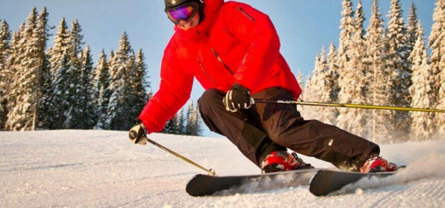
Skiing : Gulmarg is amongst the best skiing resorts in India. Gulmarg is also a good skiing sight for learners. Ski enthusiasts can easily get all required gear and equipments as well as professional ski instructors in Gulmarg, to try out a hand on skiing. The longest ski run in Gulmarg is provide by the Gondola Cable Car Lift, where skiers can swoosh down the slopes from the height of 2, 213m.

Excursions from Gulmarg

Gulmarg Biosphere Reserves : This is located at a distance of 48-km from Srinagar, to the southwest of Gulmarg. It is famous for storing several rare and endangered species such as the musk deer, and a brilliant and varied fauna.

Alpather Lake : This lake is frozen until mid-June and even later in the year one can see rocks of ice floating in its cold waters.

Categories
Destinations

Srinagar tourism

Srinagar tourism

The summer state capital is situated at an altitude of 1730 meters above sea level. It is connected by air to every part of the national network. The Srinagar Airport has already been recommended and sanctioned for the international status. Srinagar is connected by an all weather road to Jammu which in turn is connected to all parts of North India. At present Srinagar’s nearest rail head is Udhampur and the railway network upto Srinagar is in its final phase of operation

Hari Parbat Fort

To the west of the Srinagar City is the much lower hill of Hari Parbhat, which is surrounded by a fort. On this hill is the temple of Sharika Devi believed to be a form of Durga Mata or Shakti. The Mughal emperor’s fort crowns the peak of Hari Parbat hill. There is little of its former glory now, but the ramparts are still impressive and the old apartments within the fort, even though in a state of ruin, still convey at least a little of the grandeur of the Mughals summer retreat in “paradise”. The forest was later developed by an Afghan governor, Atta Mohammad Khan, in the 18th century

Mughal Gardens:

Mughal Gardens, as the name suggests, built in the Mughal period is a marvel located in Srinagar. These gardens are the major attractions of the tourists to Jammu and Kashmir. These gardens are the nice example of the Mughal style of constructing attractive places.

The name Mughal Gardens is given for the combination of three renowned gardens namely the Nishat Bagh, Shalimar Gardens and Chashmashahi. These gardens are tourists’ paradise and are beautifully decorated with bright flowerbeds, terraced lawns and well maintained cascading fountains. No tourist can miss these three nice marvelous gardens.

CHESHMASHAHI

Cheshmashahi is the first Mughal Garden you will pass after Nehru Park. Built at a height above the city, its views are as stupendous as its layout. The smallest of Srinagar’s Mughal Gardens, Cheshmashahi has only three terraces in addition to a natural spring of water enclosed in a stone pavilion.

NISHAT

The next garden along the road that encircles the Dal is the Nishat built by Empress Noor Jahan’s brother Asif Khan. The largest of the gardens Nishat has several terraces, a central water course and a majestic site between the Dal and the Zabarwan hills

SHALIMAR

The third Mughal Garden — the Shalimar was planted by Jehangir, the Mughal Emperor whose love for Kashmir was legendary. Shaded by magnificent chinar trees, the Shalimar is a series of stone pavilions and flowing water with paint box bright flower beds

Pari Mahal

Pari Mahal is situated just above Chashma Shahi Gardens, about 10 km from Srinagar, in Jammu and Kashmir. It was once a Buddhist monastery, later converted into a school of astrology by Dara Shikoh – eldest son of Mughal Emperor Shah Jahan.

Pari Mahal is a historic monument as well as a well-laid spacious garden. Situated around a small spring, the garden has beautiful flowering plants and various kinds of fruit. Although Pari Mahal boasted a large number of springs earlier, only a few can be seen today. The Mahal, on the spur of a hill, is illuminated at night and can be seen from most places in Srinagar. It overlooks the picturesque Dal Lake.


Categories
Day Hiking

Pahalgam to chunsar lake

Pahalgam to chunsar lake

Chunsar lake
  • Chunsar lake is one of the best lake in pahalgam it is a 10 hours day trek
  • High Altitude alpine lake
  • Explore: September 13,2020
  • Altitude:3717
  • Coordinates:34°03’51″N 75°12’53″E
  • Kilometers:26 tro and fro
  • Trek type:Hard (completed in 10 hours) 
  • Location:Aru pahalgam 
  • District:Islam Abad Kashmi
Categories
Day Hiking

Pahalgam to bajmarg

Pahalgam to bajmarg

Bajmarg Pahalgam #kashmir

Accessible by walk or ponies from Pahalgam this offbeat track offers panoramic sights of Lidder Valley. It is a 6 hours trek from pahalgam you can also visit surmarg valley between the path of bajmarg .bajmarg is one of the beautifull day trek in pahalgam. Bajmarg is famous for his beauty.

Categories
Day Hiking

Pahalgam to source lake

Pahalgam to source lake

Lying at the confluence of streams arising from the Sheshnag Lake and the Lidder river, Pahalgam has a number of attractions to touch the hearts of travellers and visitors. The beautiful town has today emerged as one of the premier hill resorts in the state of Jammu and Kashmir. It is perched at an elevation of 2240 m, surrounded by steep verdant hills.

Baisarn is like switzerland. It is an upland lush green pasture. Its sight makes the hearts of lookers peaceful.From Baisarn we go to another beautiful spot that is Dabyan. All along the way from Baisarn to Dabyan we see gypsyfamilies residing in mud houses. At Dabyan many gypsy families reside during warmer months of the year. Gypsy people are very simple. From Dayban we start for another beautiful place Namely “the kashmir valley”. It takes two and half hours to reach kashmir valley. We can enjoy lunch here.from here we have a view of many beautiful Hamlets. From upper Kashmir Valley we have to start journey to Churs Lake. The path was magically transforming itself into a hi-fantasy movie like Narnia; the sun was shining bright, peeping through the pine trees. The narrow brown path had different shades of green grass covered with white, yellow and light purple flowers. The lake is a stunning display of nature’s capabilities. The waters are turquoise blue and in a cauldron surrounded by snow patches feeding the waters of the lake. If ever there was a place that could come close to paradise.

Categories
Day Hiking

Pahalgam to baisaran

Pahalgam to baisaran

Baisaran Valley, located just 5 kilometers away from Pahalgam in the Anantnag district of Kashmir, is famous as a top sightseeing destination, called mini-Switzerland because of its picturesque beauty. It’s a hilltop green meadow dotted with dense pine forests and surrounded by snowcapped mountains. This famous offbeat tourist place in Jammu and Kashmir is great for those wanting to spend a quiet time in the company of nature. It also serves as a campsite for trekkers going to Tulian Lake. Some of the famous tourist points which you can see en route to Baisaran are Kanimarg, Pahalgam Old Village, Kashmir Valley Point, Dabyan and Deon Valley Point. You can also enjoy panoramic sights of Pahalgam town & Lidder Valley from here.

1. Lying at the confluence of streams arising from the Sheshnag Lake and the Lidder river, Pahalgam has a number of attractions to touch the hearts of travellers and visitors. The beautiful town has today emerged as one of the premier hill resorts in the state of Jammu and Kashmir. It is perched at an elevation of 2240 m, surrounded by steep verdant hills. 1. Baisarn is like Switzerland. It is an upland lush green pasture. Its sight makes the hearts of lookers peaceful.

2. From Baisarn we go to another beautiful spot that is Dabyan. All along the way from Baisarn to Dabyan we see gypsy families residing in mud houses. At Dabyan many gypsy families reside during warmer months of the year. Gypsy people are very simple

3. From Dayban we start for another beautiful place Namely the Kashmir valley. It takes two and half hours to reach Kashmir valley. We can enjoy lunch here. From here we have a view of many beautiful Hamlets.

4. From Kashmir valley we reach to another spot namely “water fall” away back to Pahalgam we see a village called Ganeshbal. It takes 4 to 5 hours depending upon how slow or fast we walk to reach back to Pahalgam.


Categories
Day Hiking

Shikargah day trek

Shikargah day trek

Mamalleswara is only a kilometer downstream on the opposite bank of Lidder River. A Shiv temple dating back to the 12th century with a square stone tank, lies here.

Pahalgam has within it no fewer than eight tiny villages, one of which is Mamal. There is a Shiva temple here, generally considered to be Kashmir’s oldest existing temple dating to the 8th century. Pahalgam has within it no fewer than eight tiny villages, one of which is Mamal. There is a Shiva temple here, generally considered to be Kashmir’s oldest existing temple, dating to the 5th century.

Shikargah is a renowned wildlife reserve preferred by visitors as a destination for spending quality time with family and friends. The reserve with its varied wildlife was traditionally a hunting place for the royals in the past. It is located in close proximity to the marketplace of Pahalgam which allows tourists to easily avail ponies for rides. However, walking is also a convenient option for reaching the wildlife reserve.

1.5 kms. Down the river from the bridge, there is a small ancient stone temple consecrated to Shiva Mamesvara. The temple was built before the 12th century AD, through the name of the builder is unknown. There is a stone-lined tank, about 1.1 sq.mt in dimension